
One-time map + photos
Snapshot
Starting at$399one-time
For one clear, shareable property record.
- One high-resolution orthomosaic
- A labeled PDF map: buildings, entrances, parking, pools and amenities, ponds and playgrounds
- 10–15 edited aerial photos
Communities & property teams
One clear picture of your property—for HOA boards, churches, private schools, apartment communities and parks.
One property. One clear picture.
A high-resolution orthomosaic brings the property into one overhead image. A labeled PDF identifies the features relevant to your site: buildings, entrances, parking, pools and amenities, ponds and playgrounds.
Use it for visitor orientation, maintenance planning, board records and community communications. Snapshot also includes 10–15 edited aerial photos.
Visual documentation and planning reference only—not certified measurements or engineering conclusions.
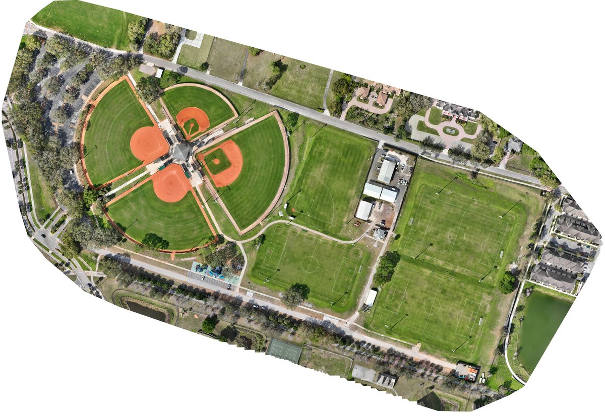
Choose your documentation scope
One-time mapping, a yearly re-fly or annual pre-storm photo documentation.
One-time map + photos
For one clear, shareable property record.
Yearly re-fly
For year-over-year comparison.
Annual photo documentation
For a dated pre-storm record.
All prices are starting prices. Larger, multi-building or multi-site properties are quoted higher. Final scope, property size, access and travel are confirmed in your written quote. Flights depend on safe weather, site access and applicable airspace requirements.
Storm-Ready · Annual documentation
Starting at $175/year
Dated pre-storm aerial and ground photos of buildings and grounds, captured by a licensed Florida adjuster who knows what carriers expect to see.
Annual pre-storm photo documentation is also available without a map package. Documentation only—never adjusting or representing a claim.
Capture areas and timing are agreed in your quote. Flights depend on safe weather, access and airspace requirements.
Request a Storm-Ready quoteDated photos help owners keep a visual record of conditions before damage. No carrier approval, coverage decision or claim outcome is promised.
Volusia, Seminole, Flagler and Lake counties. St. Johns and Putnam: construction, commercial and industrial projects only.
All prices are starting prices; larger, multi-building and multi-site properties are quoted higher.
Starting at $349/year, Annual Baseline includes the initial baseline map and a yearly re-fly for year-over-year comparison. The initial baseline map is not separately priced. Larger, multi-building or multi-site properties are quoted higher.